Walking the Regent's Canal - Little Venice to Limehouse
One towpath across the city: the quiet east-west route most Londoners never finish.
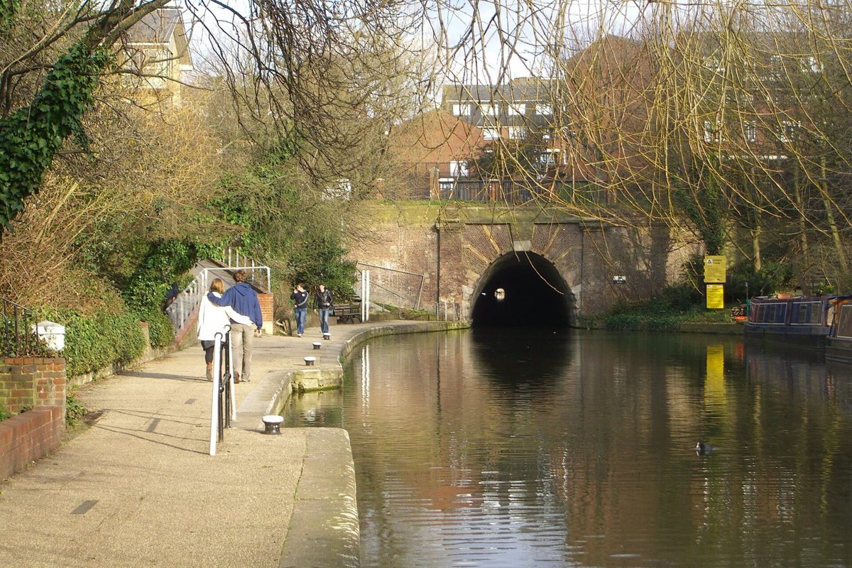
The Regent's Canal runs nine miles across north London from Little Venice to Limehouse Basin. A west-to-east walk passes Little Venice, Regent's Park, Camden Lock, King's Cross, Victoria Park and Limehouse Basin. Each section keeps evidence of the canal's freight past, from locks and bridges to warehouses and basins. Key stops, west to east: - Little Venice, the junction with the Paddington Arm - Regent's Park and the Macclesfield Bridge - Camden Lock and its twin locks - King's Cross, Granary Square and Coal Drops Yard - Victoria Park in Hackney - Limehouse Basin, where the canal meets the Thames
Little Venice
Little Venice is the junction where the Regent's Canal meets the Paddington Arm. It was built as a canal basin and interchange point, a place for boats to turn, load, and store goods. The pool itself survives, along with the broad basin and the surrounding Regency stucco terraces. What to look at: the willow-fringed island, the narrowboats moored along the banks, the bridges, and the way the water opens out before narrowing into the canal proper. The area takes its name from a local nickname rather than from any official designation. For a first-time walker, this is the place to notice the canal's basic geometry: a wide basin gives way to a narrow channel, and the towpath begins as a working edge rather than a promenade.
Regent's Park and London Zoo
This stretch was engineered to carry goods through a planned landscape rather than around it. The canal runs along the northern edge of Regent's Park, and the route includes the Macclesfield Bridge, also known as the "Blow-up Bridge" after an explosion in 1874. What survives: the bridge abutments, the ironwork, and the canal's curved alignment through the park. What to look at: the back gardens of the villas, the glimpses of London Zoo across the water, and the contrast between the formal park and the industrial towpath. The zoo's aviary and enclosures are visible from the water in places. The bridge's nickname is a useful reminder that canal infrastructure was not decorative; it carried fuel, food, and building materials through a city that was expanding quickly.
Camden Lock
Camden Lock was built as a working lock and market site, part of the canal's commercial life. The twin locks survive, along with the lock-keeper's cottage and the surrounding warehouse buildings. What to look at: the lock gates in operation, the stonework, the former stables and warehouses now housing markets and workshops, and the way boats queue to pass through. The area's character comes from the mix of canal engineering and later market reuse. A good moment to pause is when a boat enters the lock and the water level changes; the mechanism is simple, but it explains how the canal moved between different heights without pumps or electricity.
King's Cross - Granary Square and Coal Drops Yard
This section was built to serve the goods yards of King's Cross. The canal here fed warehouses, coal stores, and granaries that handled freight from the north. What survives: the granary building itself, the Coal Drops Yard structures, and the widened basin area. What to look at: the restored brick arches, the canal's edge at Granary Square, the fountain steps, and the way old freight infrastructure now sits beside new public space. The water still runs through the heart of the development. The Coal Drops Yard name is not merely branding; it refers to structures where coal was unloaded and stored, and their arches still show the scale of that trade.
Victoria Park
Victoria Park sits beside the canal as it moves east through Hackney. The park was laid out in the Victorian period, and the canal edge forms part of its boundary. What survives: the towpath, the bridges, and the park's original layout with its lakes and avenues. What to look at: the view across the park from the water, the bridges, and the transition from central London to a greener, more residential edge. The canal here feels wider in spirit, with more sky and fewer warehouses. This is also where the walk changes character: the dense central sections give way to longer sightlines, and the waterway reads more as a landscape feature than as a freight route.
Limehouse Basin
Limehouse Basin is where the Regent's Canal meets the Thames. It was built as a tidal basin and interchange, allowing narrowboats from the canal network to transfer goods to river craft. What survives: the basin itself, the lock connecting to the Thames, and the surrounding warehouses. What to look at: the water level changes with the tide, the lock gates, the basin's shape, and the view out toward the river. It is the natural end of a west-to-east walk. The tidal movement is the key difference from the rest of the route: here the canal stops being a self-contained system and becomes a link to the wider port.
The working history of the canal
The Regent's Canal opened in stages in the early nineteenth century and was built to move bulk goods - coal, timber, grain, and building materials - across London without relying on the crowded streets. Horses pulled barges along the towpath, and the locks raised and lowered boats between levels. Basins at Paddington, Camden, and Limehouse allowed loading, turning, and transfer to other routes. Over time, railways took much of the freight, and the canal shifted toward leisure use. The structures that remain, from locks to warehouses, are the physical record of that freight economy. Walking the full route makes that history legible: you can see where boats turned, where goods were stored, and where one transport system handed work to another.
Frequently asked questions
Can you walk the whole Regent's Canal?
Yes, the towpath runs from Little Venice to Limehouse Basin, and you can follow it as one continuous walk. Some sections are narrower or busier than others, and you should take care where the path passes beneath bridges or alongside water without barriers.
What is the best section for a short walk?
Little Venice to Camden Lock gives a compact route with locks, bridges, and changing scenery, while King's Cross to Victoria Park offers a longer stretch through regenerated and greener ground. Both are straightforward on foot and easy to reach by public transport.
Is the canal still used by boats?
Yes, narrowboats and other craft still use the waterway. You may see residential boats, hire boats, and working vessels, especially near the locks and basins. The towpath is shared, so give way to boats passing through locks and to anyone handling ropes or gates.
This is an independent member's guide compiled by London BGTC Society. We are not affiliated with the venues and institutions mentioned; opening arrangements and programmes change - always confirm details on the official websites before making plans.
← Back to Events