London along the Thames - a riverside member's guide
The river is London's oldest through-line: a walkable guide to the culture, landmarks and views along the Thames.
Walking the Thames Path offers the most coherent route through London's layered history. The South Bank anchors this route with the Southbank Centre, the National Theatre, Tate Modern, and Shakespeare's Globe. Moving east, Tower Bridge connects the South Bank to Wapping, while Greenwich culminates the walk with the Cutty Sark, the Royal Observatory, and Maritime Greenwich. For a shift in perspective, the Tate-to-Tate boat provides a practical link between the two major art galleries along the river.
The South Bank - Cultural Anchors and Brutalist Concrete
The South Bank stretches from Westminster Bridge to the London Eye, extending east past Waterloo Bridge. This area transformed from an industrial riverside into a continuous cultural district. The Southbank Centre comprises the Hayward Gallery, Queen Elizabeth Hall, and the Royal Festival Hall. The architecture is polarizing Brutalist concrete, but the public spaces underneath and around these venues host continuous free events, markets, and skateboarding activity. Adjacent to the centre, the terraces of the National Theatre offer elevated views of the river and feature distinct blue, red, and green foyers open to the public during the day.
Further east along the riverfront sits the Oxo Tower, famous for its historically subversive neon sign, and the Bargehouse, a raw exhibition space. This stretch culminates at Tate Modern, housed in the former Bankside Power Station. The Turbine Hall inside Tate Modern hosts massive, temporary installations, while the Bruce Nauman sound installation in the concrete lift shaft remains a permanent, disorienting feature. Just beyond Tate Modern lies the reconstruction of Shakespeare's Globe, an oak-and-thatch building based on the original 1599 theatre. The Sam Wanamaker Playhouse, an indoor candlelit theatre attached to the Globe, offers a different acoustic and atmospheric experience. What to see: The Tate Modern Turbine Hall, the Globe's open-air yard, and the National Theatre's outdoor concrete terraces. Why it matters: This stretch represents the most successful post-war urban reclamation project in London, turning derelict industrial docks into a continuous public space. Walking tip: Walk along the riverfront promenade at the ground level to avoid the upper road. Look for the hidden doorways embedded in the river wall at low tide, remnants of the old docks.
Tower Bridge to Wapping - The Engine Room and the Smugglers
Tower Bridge serves as the physical gateway to the East End. Built between 1886 and 1894, the bridge features a central bascule mechanism that still opens for large vessels. The high-level walkways were originally designed for pedestrians to cross when the bridge was raised, though they gained a glass floor section in recent years. Crossing to the north side offers immediate access to the Tower of London. However, the south side of the river near the bridge holds distinct historical weight. Butlers Wharf, just east of the bridge, features restored warehouses that once stored tea, coffee, and spices arriving at the nearby docks.
Moving east past Butlers Wharf into Wapping reveals the historic Execution Dock. Pirates and smugglers were hanged here in chains at low tide, left to drown as the water rose three times over. The Prospect of Whitby pub sits directly on this site, retaining its original 18th-century stone floor and pewter-topped bar. Further along Wapping High Street, the old dock infrastructure remains visible. The Thames Path here becomes a narrow, winding street that forces walkers directly past the brick facades of former warehouses, many of which still feature large loading hooks under their eaves. What to see: The Victorian engine rooms showing the steam-powered machinery that originally raised the bridge, and the Execution Dock at Wapping. Why it matters: Tower Bridge is a feat of Victorian engineering, while the Wapping stretch preserves the physical infrastructure of London's maritime trade and its darker colonial history. Walking tip: Walk across the upper glass walkway of Tower Bridge, then descend to the south side to pick up the Thames Path eastward toward Wapping High Street. The path narrows significantly here, so visit during off-peak hours.
Greenwich - Maritime Grandeur and the Prime Meridian
Maritime Greenwich forms the eastern anchor of the Thames Path. The Cutty Sark sits in a dry dock at the riverside. This 1869 tea clipper is one of the fastest sailing ships ever built. The ship is suspended above the floor, allowing visitors to walk directly underneath the copper-clad hull and inspect the innovative iron frame. Just steps away sits the Discover Greenwich Visitor Centre, housed in the former Pepys Building of the Royal Naval College. The Royal Naval College itself, designed by Christopher Wren, features the Painted Hall, often called the Sistine Chapel of the UK, taking James Thornhill 19 years to complete.
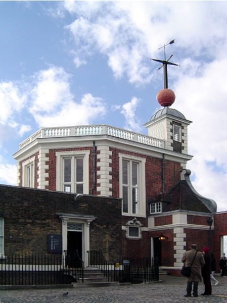
The path leads uphill from the riverfront through Greenwich Park to the Royal Observatory. Founded by King Charles II in 1675, the observatory sits on the Prime Meridian Line at Longitude 0 degrees. John Harrison's marine chronometers, which solved the problem of calculating longitude at sea, are displayed inside the observatory. The main telescope inside the Great Equatorial Building offers views across the city. The walk up the hill through Greenwich Park provides a panorama of the Greenwich Peninsula and the O2 Arena, framed by the twin domes of the Naval College below. What to see: The hull of the Cutty Sark, the Painted Hall, and the Prime Meridian Line at the Royal Observatory. Why it matters: Greenwich is the literal center of global timekeeping and navigation, a site that standardized how the world measures distance and time. Walking tip: Do not walk up the main avenue in Greenwich Park. Take the zig-zag path through the flower garden and the Observatory garden to the south side of the hill for a quieter ascent.
The Thames Path - A Continuous Walking Route
The Thames Path is a National Trail stretching 184 miles from the source of the Thames in Kemble, Gloucestershire, to the Thames Barrier in Woolwich. The central London section effectively links all the cultural and historical landmarks mentioned above. The path uses public rights of way along the riverbanks, utilizing promenades, towpaths, and occasionally pavements when the river edge is privately owned. Walking the path from the South Bank to Greenwich covers approximately five miles and requires no navigation skills, as the river is a constant guide on one side. What to see: The varying architecture of the river wall, the remnants of old ferry steps, and the changing width of the tidal river itself. Why it matters: The path stitches together disparate neighborhoods into a single continuous route, providing a linear timeline of London's development from Westminster to the docks. Walking tip: Check the tide times before walking the Wapping and Rotherhithe sections. At high tide, the river looks dramatically different, and some lower paths near the water edge can be submerged.
The Tate-to-Tate Boat - A Functional River Crossing
The Tate-to-Tate boat provides a direct transport link across the river between Tate Modern on Bankside and Tate Britain in Millbank. The vessel itself is a distinctive silver and black speedboat, decorated with a Damien Hirst dot pattern. The journey takes approximately 20 minutes, navigating the bend in the river past Lambeth Palace and the Houses of Parliament. The boat departs from the Millbank pier directly outside Tate Britain and the Bankside pier adjacent to the Globe Theatre. This route serves as a practical concept for viewing the river from the water without committing to a full sightseeing cruise. What to see: The Damien Hirst-designed exterior of the boat, the rear view of the Houses of Parliament, and the approach to the MI6 building at Vauxhall. Why it matters: The boat connects two of London's major art institutions while utilizing the river as a functional commuter route rather than just a tourist attraction. Walking tip: Sit on the starboard (right) side of the boat when traveling from Tate Modern to Tate Britain for the best views of the Westminster skyline as the boat rounds the bend.
Frequently asked questions
How long does it take to walk the Thames Path from the South Bank to Greenwich?
Walking the Thames Path from the Southbank Centre to the Cutty Sark in Greenwich takes approximately two hours at a brisk pace. The distance is roughly five miles. Walkers who plan to stop at the National Theatre, Tate Modern, the Globe, and Tower Bridge should allocate an entire day. The terrain is entirely flat and paved, making it accessible for standard footwear, though the Wapping section features some narrow pavements.
Can you walk inside the Globe Theatre without buying a ticket for a play?
Yes, the Globe offers a guided tour that takes visitors inside the open-air theatre when rehearsals are not taking place. The tour provides access to the yard, the galleries, and the stage. The adjacent Sam Wanamaker Playhouse, the indoor candlelit theatre, is also included in the tour. Booking in advance is recommended during peak summer months when the theatre is in active use.
Is the walk to the Royal Observatory in Greenwich steep?
The walk from the Cutty Sark to the Royal Observatory involves a continuous incline through Greenwich Park. The ascent takes about fifteen minutes from the riverfront to the Prime Meridian. The main avenue features a paved path, but the alternative zig-zag paths through the parkland offer a slightly gentler gradient. Wheelchair users can access the observatory via a vehicle road that runs along the eastern edge of the park, avoiding the steepest pedestrian routes.
This is an independent member's guide compiled by London BGTC Society. We are not affiliated with the venues and institutions mentioned; opening arrangements and programmes change - always confirm details on the official websites before making plans.
← Back to Events